Artificial Intelligence for Real-Time Climate Disaster Forecasting
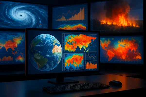
Artificial intelligence has become a central instrument in real-time climate disaster forecasting, enabling specialists to detect early-warning signals with unprecedented precision. By 2025, the integration of advanced neural networks, satellite data streams, and high-frequency environmental monitoring systems has transformed how societies prepare for extreme weather. This approach significantly strengthens early preparedness and supports evidence-based decision-making in regions exposed to growing climatic instability.
Evolution of Real-Time Climate Forecasting Since 2020
The global scientific community has spent the past five years refining AI systems capable of processing vast climate datasets in seconds. Modern forecasting models now operate on continuous data ingestion, relying on satellite imagery from agencies such as ESA and NASA, oceanic sensors, and high-resolution atmospheric measurements. These technologies allow specialists to analyse rapid changes in temperature, humidity, and wind formation at a scale that traditional meteorological tools could not manage effectively.
Researchers have also expanded machine-learning models designed to recognise early signatures of catastrophic events. For instance, recurrent neural networks (RNNs) and transformers are widely used to detect rapid shifts associated with tropical cyclones, atmospheric rivers, and severe storms. The models compare present conditions with historical patterns, offering a deeper contextual understanding of how extreme events might unfold.
Another major step forward is the operational reliability of real-time systems. Cloud-based climate engines process live data continuously, delivering updates to emergency response agencies with minimal delay. This speed is essential for timely evacuations, infrastructure protection, and cross-border climate coordination.
How AI Improved Warning Accuracy and Lead Time
One of the most important advancements is the noticeable extension of lead time for hazard notifications. Between 2022 and 2025, European meteorological institutions recorded up to a 30% improvement in early-warning issuance for severe storms, largely due to AI-driven detection algorithms. These systems evaluate subtle atmospheric anomalies and produce alerts before traditional forecasting models detect them.
Accuracy has also improved because AI eliminates a considerable proportion of false alarms. Machine-learning algorithms continuously retrain using fresh observational data, enabling them to adjust to shifting climate patterns. This capability is particularly valuable in a world where anomalies are becoming more frequent and less predictable.
In addition, AI-generated forecasts now include uncertainty assessments. These assessments help specialists understand the likelihood range of upcoming events rather than relying on rigid predictions. As a result, government agencies and humanitarian organisations can allocate resources more efficiently and reduce unnecessary mobilisation.
AI Applications for Predicting Specific Climate Disasters
Different types of climate hazards require dedicated analytical frameworks. Flood forecasting systems, for example, combine hydrological modelling with AI-enhanced river flow prediction. Such systems track rainfall accumulation, soil saturation, and real-time river levels, helping identify potential overflow zones hours before actual flooding occurs.
Wildfire prediction tools rely heavily on satellite thermal imaging paired with machine-learning algorithms. These models assess vegetation dryness, wind speed, and ignition points, allowing specialists to predict fire spread trajectories. By 2025, these systems have been deployed across Southern Europe, Australia, and North America to help safeguard vulnerable communities.
Drought forecasting tools benefit from AI’s ability to analyse long-term precipitation patterns, groundwater levels, and agricultural data. This supports countries facing prolonged dry seasons, giving policymakers more time to implement water conservation measures and protect food production chains.
Integration with Emergency Response Systems
AI-enabled systems are now deeply integrated with national emergency response frameworks. When a threat is detected, automated protocols transmit early alerts to local authorities, who in turn notify residents using regional broadcasting systems and mobile alerts. This ensures the rapid circulation of critical information.
Some governments are adopting predictive evacuation planning tools powered by AI. These systems simulate road congestion, population density, and shelter capacity, helping authorities structure more efficient evacuation routes during severe storms, floods, or fires. Such tools reduce human error and strengthen operational coordination.
AI-driven mapping technologies also support on-ground rescue teams. These systems generate high-resolution hazard maps, showing the expected impact on infrastructure, transport networks, and residential areas. Humanitarian teams use these maps to plan resource distribution, search-and-rescue operations, and medical assistance deployment.

Ethical Considerations and Reliability of AI Climate Forecasting
As AI becomes more central in predicting climate disasters, questions of transparency, reliability, and governance have gained prominence. Specialists emphasise the need for clear model documentation, ensuring that governments and researchers understand how decisions are generated. This transparency is essential when forecasts influence public safety.
Another important concern is equitable access to forecasting technology. Some regions lack the infrastructure required for real-time data collection, creating disparities in disaster preparedness. By 2025, several global climate institutions are working on open-access AI tools to support lower-income countries in strengthening resilience.
Data privacy is also central, especially where predictive models incorporate population movement or urban activity patterns. Responsible use guidelines require institutions to follow strict anonymisation standards, ensuring that forecasting remains focused on environmental analysis rather than individual behaviour.
Future Development and Opportunities for 2030 and Beyond
Researchers expect that forecasting systems will continue moving toward hyper-local precision. This means that predictions will no longer focus solely on cities or regions but will identify risk conditions street by street. Achieving this requires further improvements in sensor networks and shared climate databases.
Generative AI models show strong potential in simulating climate scenarios based on multiple variables. These simulations help specialists evaluate the potential impact of emerging hazards and plan mitigation strategies years in advance. Such tools may significantly influence urban planning, agriculture, and energy infrastructure development.
International collaboration is likely to expand as climate risks intensify. Cross-border data-sharing projects allow specialists to build more comprehensive forecasting systems, reducing the likelihood of unexpected environmental shocks. AI plays a vital role in harmonising such data and generating reliable predictions regardless of national boundaries.